Road Conditions
Road Condition provides information on Road Surface Temperature and Precipitation details at a specific location of the service area.
All the Road Conditions are reported by Supervisors or Inspectors using the Supervisor App.
Road Conditions Page
The Road Conditions page is accessible through the main menu of the Web Portal and contains all reported conditions.
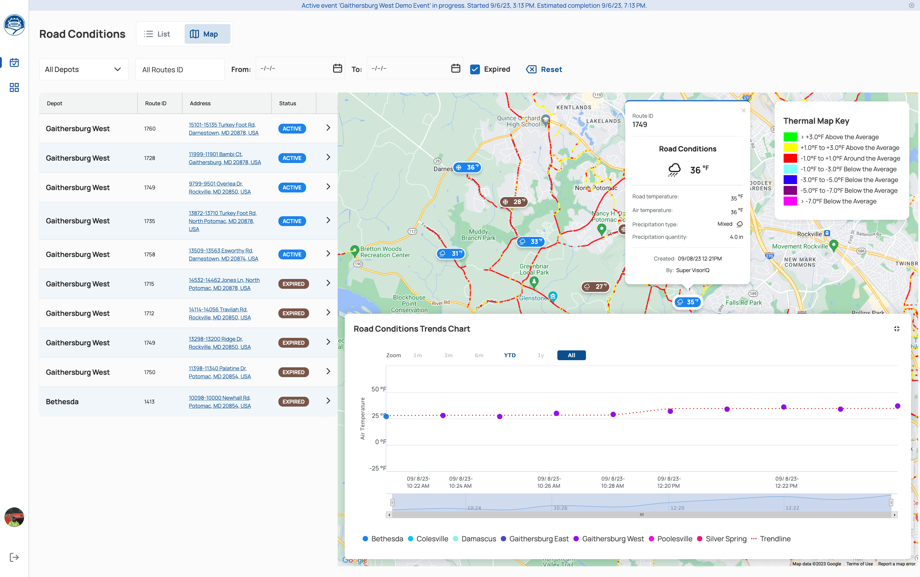
The road conditions page can present items in two modes: List and List+ Map. To change the mode, click on the switch in the upper left corner of the screen.
The list can be filtered and sorted by Depot, Route ID, and time frame. The user can also show/hide expired conditions by clicking the “Expired” checkbox.
Thermal Map
The map contains an additional visualization thermal layer.
The Thermal Map displays color-coded temperature variations corresponding to the route segments of the service area.
The map has a thermal map key which is a map legend that displays the temperature bracket for each color representing data on the map.
Trends Chart
The map also contains the Road Conditions Trends Chart module in the right lower part of the screen.
The Road Conditions Trends Chart is a graph representing temperature changes.
The Trends Chart can be shown or hidden by selecting the plus icon (+) in the right part of the module.
It can be also customized by sliding the time frame bracket.
Road Conditions Expiration
All Road Conditions automatically expire within 1 hour after being reported.
Upon expiration, the status of a condition is changed from ‘Active’ to ‘Expired’, and the marker color is changed from blue to brown.